


Blog > Coastal A Zones and the LiMWA Line: What an AE Rating Won't Tell You on the Mississippi Gulf Coast
Coastal A Zones and the LiMWA Line: What an AE Rating Won't Tell You on the Mississippi Gulf Coast
by
By Randy Richardson, Broker Associate, The 4th Right Team
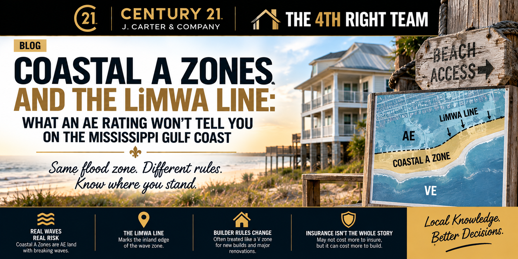
Quick Answer: A Coastal A Zone is the part of a FEMA AE flood zone closest to open water, where a 1% annual chance storm can push breaking waves 1.5 to 3 feet high. The LiMWA, short for Limit of Moderate Wave Action, is the line on the flood map that marks the inland edge of that strip. For NFIP flood insurance, it doesn't price much differently than the rest of AE. What it changes is how a home has to be built, rebuilt or added onto, because building codes since 2015 treat it much like a V zone. If you're buying near the water and plan to renovate or build, find out which side of the line you're on first.
What is a Coastal A Zone on a flood map?
A Coastal A Zone is AE land that still gets hit by real waves in a big storm. It sits between the V zone and a line FEMA calls the LiMWA.
A VE zone is where a 100-year storm brings waves of 3 feet or higher. An AE zone floods with smaller waves. But FEMA's post-storm surveys kept finding that waves as small as 1.5 feet do serious damage to buildings that weren't designed for them.
So on newer maps, FEMA split AE in two. The seaward strip is the Coastal A Zone, and the LiMWA marks where it stops. It shows up as a black line with small arrows pointing toward the water side. If you're comparing flood zone AE vs X, this is the next layer down, and most buyers never hear about it.
Why does the LiMWA line matter so much on the Mississippi Coast?
Because we learned it the hard way. In December 2005, FEMA put out a Hurricane Katrina recovery advisory on this exact problem. It found that typical A zone construction, meaning walls on slabs or shallow footings, fails under breaking waves smaller than 3 feet. One of its photos from Katrina showed wood framing, brick veneer and windows knocked out by 4 feet of water and small waves. At the time, the Coastal A Zone wasn't drawn on any flood map.
FEMA started drawing the LiMWA on coastal maps in 2009. Harrison County's flood study now notes that its AE zones are divided by the line. If you own or are shopping for a pre-Katrina home near the water, this is part of why it may have been built to rules that don't fit its spot on today's map.
The line doesn't follow streets. It depends on how deep the storm water gets and whether trees and buildings between you and the shoreline break the waves up. Two bay front homes that look alike from the road can land on different sides of it.
Does a Coastal A Zone raise my flood insurance on the Coast?
For NFIP flood insurance, usually not by much. It also doesn't change whether your lender requires flood coverage, because any AE zone already triggers that.
Kelsey Carlson, CISR Elite, a Personal Lines Risk Advisor at Lemon Mohler Insurance, told me that under FEMA's Risk Rating 2.0, a Coastal A Zone doesn't price separately from a regular A zone the way it used to. All else equal, a home half a mile from the beach and one half a mile from a bayou or lake rate about the same. She was also clear that she can't speak for how private flood carriers price it.
Get an insurance quote before you write an offer on the exact address. It's the only way to know how much insurance costs for that house.
How does the LiMWA change what you can build or rebuild?
This is where the line really costs money. FEMA's own minimum flood rules don't require V zone construction in a Coastal A Zone, but FEMA strongly recommends it. The building codes go further.
Since 2015, the International Building Code, International Residential Code and ASCE 24 flood standard treat the Coastal A Zone like a V zone wherever the LiMWA is on the map. In plain terms, that means an open foundation on piles, piers or columns instead of a slab, the floor framing raised above the flood level, and breakaway walls on anything enclosed underneath. Backfilled stem walls engineered for wave loads are the one exception.
That's a very different house and budget than a slab ranch. Which code edition your city enforces, and whether it adds its own rules, is a question for the local building department. Ask before you buy the lot.
When does a buyer or seller actually run into this?
Most owners seaward of the LiMWA never deal with it until one of three things happens. The first is building new, which means pricing a V zone style home from day one.
The second is a big renovation. Under FEMA's substantial improvement rule, if the work costs 50% or more of the building's market value, the whole house has to meet current flood rules. Some communities set a lower threshold. For an older slab home seaward of the line, that could mean a foundation it doesn't have, and the remodel becomes a rebuild. The third is storm damage, since the same 50% test applies to repairs.
Sellers, this shows up on paper too. The current FEMA elevation certificate has a question, item B13, asking whether the building is seaward of the LiMWA. Read that line before a buyer does, so you can price and explain the house on your terms.
How do I check whether a Gulf Coast home is seaward of the LiMWA?
Start with FEMA's flood map and look for that black line with arrows. Then confirm it with the city or county floodplain administrator. That call is free. If there's an elevation certificate, item B13 answers it too.
The line can also move. A locally led effort called the Mississippi Coastal Map Revision Project is redoing the coastal flood maps for Hancock, Harrison and Jackson counties, and its maps will show the LiMWA. As of September 2026, the project's update page still lists those maps as in development, so today's line isn't guaranteed to be tomorrow's. If you're buying near open water in Bay St. Louis, Pass Christian, Long Beach or Ocean Springs, ask whether a map change is coming for that area.
By the Numbers
VE zone wave height in the base flood: 3 feet or higher
Coastal A Zone wave height in the base flood: 1.5 to 3 feet
FEMA's Katrina advisory on Coastal A Zones: December 2005
First year FEMA drew the LiMWA on coastal maps: 2009
Code editions that treat the Coastal A Zone like a V zone: 2015 and later IBC, IRC and ASCE 24
Substantial improvement or damage trigger: 50% of the building's market value
Elevation certificate item that asks about the LiMWA: B13
The Bottom Line
An AE rating tells you flood insurance is required. It doesn't tell you whether real waves reach the house in a big storm. That's the LiMWA's job. For most owners it won't change the flood premium, but it can change what you're allowed to build, how you rebuild and what a big remodel really costs. Check the line before you fall for a house near the water.
If you're selling a home near the water, I can help you get ahead of these questions with a home value evaluation. If you're buying, my buyer's guide walks you through the steps, flood checks included.
Frequently Asked Questions
What is a Coastal A Zone and the LiMWA?
A Coastal A Zone is the part of a FEMA AE flood zone nearest open water, where a 1% annual chance storm can produce breaking waves 1.5 to 3 feet high. The LiMWA, or Limit of Moderate Wave Action, is the line that marks its inland edge.
Does being in a Coastal A Zone raise my flood insurance?
For NFIP policies, usually not much. Under Risk Rating 2.0, elevation and distance to water drive the price more than the Coastal A label. Private carriers may rate it differently, so get a quote on the exact address.
Can I build a slab home in a Coastal A Zone?
Usually not under current codes. Where the LiMWA is mapped, the 2015 and later International codes treat it like a V zone, which generally means an open foundation. Check with your local building department.
Sources
LiMWA and Coastal A Zone definitions, 1.5 to 3 foot waves, codes requiring V zone standards: FEMA, Features of Flood Insurance Rate Maps in Coastal Areas
V zone standards recommended but not required by the NFIP in Coastal A Zones, Community Rating System credit: FEMA, Implementing the Limit of Moderate Wave Action in Coastal Communities
How the LiMWA appears on flood maps: FEMA Fact Sheet, Using the Limit of Moderate Wave Action (May 2021)
Katrina findings on Coastal A Zone damage and site factors: FEMA Hurricane Katrina Recovery Advisory, Design and Construction in Coastal A Zones (December 2005)
2015 and later IBC, IRC and ASCE 24 Coastal A Zone requirements and stem wall exception: FEMA Quick Reference Guide, Comparison of Select NFIP and 2018 I-Code Requirements
Building code requirements that exceed the NFIP: FEMA Fact Sheet, Significant Building Code Requirements That Exceed the NFIP (2021)
LiMWA mapping beginning in 2009: Reduce Flood Risk, Limit of Moderate Wave Action glossary entry
Harrison County LiMWA map note: Harrison County, Mississippi Flood Insurance Study, Volume 1 (MDEQ)
Coastal map revision status and LiMWA on new workmaps: Mississippi Coastal Map Revision Project, Announcements
Substantial improvement and substantial damage 50% rule: FEMA, Understanding Substantial Improvement and Substantial Damage
Elevation certificate item B13: FEMA Elevation Certificate, 2023 edition (state-hosted copy)
Coastal A Zone flood pricing under Risk Rating 2.0: Kelsey Carlson, CISR Elite, Personal Lines Risk Advisor, Lemon Mohler Insurance, written answers, September 2026
About the Author
Randy Richardson is a Broker Associate and Team Leader of The 4th Right Team at CENTURY 21 J. Carter & Company. He serves buyers and sellers across the Mississippi Gulf Coast.
Randy Richardson | Broker Associate
The 4th Right Team | Century 21 J. Carter & Company
📞 Office: (228) 731-3881 | Cell: (228) 547-9999
📧 realtorrandyrichardson@gmail.com
🌐 www.The4thRightTeam.com
Looking to SELL or BUY? I know a GUY!