


Blog > North of I-10, Near the Tracks, or On the Water: Comparing the Gulf Coast's Three Bands
North of I-10, Near the Tracks, or On the Water: Comparing the Gulf Coast's Three Bands
by
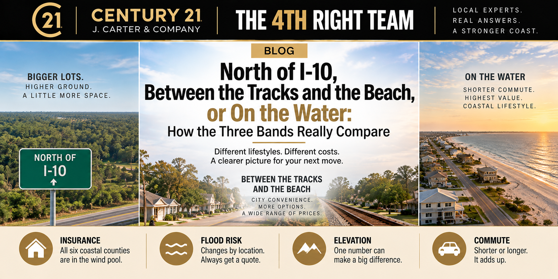
North of I-10, Between the Tracks and the Beach, or On the Water: How the Three Bands Really Compare
By Randy Richardson, Broker Associate, The 4th Right Team
Quick Answer: The Mississippi Gulf Coast breaks into three bands that run east to west, and where you land changes your monthly payment more than the house itself does. North of I-10 you get bigger lots, higher ground, and usually no flood requirement, but you're still in wind pool territory and you're adding drive time. Between the railroad tracks and I-10 you get city services, mixed flood zones, and the widest range of prices. South of the tracks and on the water you get the shortest commute and the highest price per square foot, plus flood and wind costs that can add hundreds of dollars a month. The single biggest myth is that moving north of I-10 gets you out of coastal insurance. It doesn't. Wind coverage is priced by county, and all six coastal counties are in.
What actually separates the three bands
People talk about the Coast like it's a line of cities. It's really a stack of strips, and every city sits across all three of them. Gulfport has beachfront and it has land up past the interstate. Same with Biloxi. Same with Bay St. Louis. So when somebody tells me they want to be "in Ocean Springs," that tells me almost nothing about what their payment is going to look like.
The northern band is Saucier, Vancleave, Kiln, Perkinston, McHenry, Wiggins, and the Woolmarket side of Biloxi. Bigger lots, more acreage, often septic and well instead of city utilities. The middle band is most of the housing stock on the Coast, everything from the railroad up to the interstate, on sewer and city water. The southern band is the Highway 90 corridor, the beachfront, the bays, the bayous, and the canals.
Four things move when you cross those lines. Insurance, elevation, commute, and price per foot. Let's take them one at a time, because three of the four don't work the way people assume.
Insurance is the biggest gap, and not for the reason you think
Here's the part that surprises almost every buyer I work with. Mississippi's wind pool covers six whole counties by statute: Hancock, Harrison, Jackson, Pearl River, Stone, and George. Not a strip. Not a mile line off the beach. Counties. So a house in Wiggins sits in the same statutory coast area as a house on the beach in Long Beach. Building code works the same way. Those six counties can't opt out of the stricter wind provisions the way inland counties can.
What that means in practice is that moving north of I-10 doesn't get you out of wind and hail exposure. Most carriers writing on the Coast today include wind and hail right in the base homeowners policy. Some still exclude it, and when they do you're shopping that coverage separately. Your rate improves as you move north because you're farther from open water, but the category doesn't disappear.
Flood is where the real separation happens, and flood is always a separate policy no matter where you buy. Bridgeway Insurance Agency published Mississippi ranges in April 2026 that line up with what I see at the closing table. Low-risk Zone X properties, common inland and on higher ground, run roughly $400 to $800 a year. Zone A and AE run roughly $1,200 to $2,500. Coastal V and VE zones, the storm surge zones, run roughly $2,000 to $5,000 and up. AskDoss put the statewide average near $1,100 a year in March 2026, with Gulf Coast properties averaging closer to $3,200. Those are estimates from insurance sources, not FEMA figures, so treat them as a starting range and quote the actual address before you write anything.
One more wrinkle. Under FEMA's Risk Rating 2.0, distance to water counts, and that includes rivers, bayous, and creeks, not just the Gulf. The Wolf, the Jourdan, the Tchoutacabouffa, and the Biloxi River all run north of the interstate. North of I-10 is not automatically out of a flood zone.
Elevation is the thing you can actually check
Insurance is a quote. Elevation is a fact, and it's the one number a buyer can verify before they get emotionally attached to a house.
South of the railroad tracks, you're often in mapped flood zones and the difference between a manageable premium and a brutal one comes down to how many feet the finished floor sits above base flood elevation. That's exactly what an elevation certificate tells you. If the seller has one, ask for it in writing before your inspection period ends. If they don't, get one ordered.
This is also where the construction date matters. A home elevated after Katrina under current code prices differently than an original slab home two streets over that never came up. Two houses, same block, same square footage, completely different premiums. That's not the carrier being unfair. That's Risk Rating 2.0 doing what it was built to do.
What the commute really costs
Drive times north of the interstate are longer than people budget for. Roughly speaking, and these are ordinary off-peak estimates rather than measured averages, Saucier to Gulfport runs about 25 to 30 minutes. Vancleave to Pascagoula is similar. Kiln to Bay St. Louis is closer to 20. Wiggins to the beach is more like 45 to 50, and that one catches people off guard.
If you're stationed at Keesler or working at NCBC Gulfport, both of those sit south of the interstate. So does Ingalls in Pascagoula. Buying north means you're driving south every workday, and Highway 49 and Highway 67 get busy at shift change.
Run the math honestly. Fifty extra miles a day at current gas prices, plus the wear, plus the hour of your life, is a real number. Sometimes it's smaller than the insurance savings. Sometimes it isn't. That's a calculation, not a feeling, and it's worth doing before you fall for a place on five acres.
Price per foot, and why the headline number misleads
Price per square foot is the cleanest way to compare across the three bands, as long as you're honest about which metric you're quoting.
Citywide, Gulfport's median sold price per square foot was $141 over the six months ending September 6, 2026, according to Resideline. Redfin put Gulfport's median sale price per square foot at $136 in November 2025. Those are close, and both are sale figures, not list figures. Don't mix them with median list price or typical home value. Those are different metrics that answer different questions.
The problem is that a citywide number blends all three bands together, so it describes almost nobody. Waterfront pulls the top of the range hard. Older interior stock pulls the bottom. The middle band is where most of the volume sits, and it's the number closest to what a typical buyer actually pays.
North of I-10 the per-foot number usually looks lower, but you're buying land with the house, and land doesn't have a square footage. A house on three acres in Vancleave and a house on a quarter acre in D'Iberville can't be compared on price per foot alone. And in the thin markets, Pass Christian, Kiln, Vancleave, Waveland, Saucier, and Wiggins, monthly medians bounce around badly because so few homes sell in any given month. Price those off comparable acreage and comparable square footage, not off a monthly median. Our market snapshot breaks it down closer to the neighborhood level, and you can see the city-by-city price picture for the bigger markets.
How I'd actually think about it
Start with your total monthly number, not the sale price. Take the payment, add the tax escrow, then add the real insurance quote for that specific address. A payment calculator gets you the first part. The insurance part is the one that swings, and on the Coast it can swing by three hundred dollars a month between two houses that list for the same money.
Then check roof age on anything you're serious about, in every band. A twenty-year-old roof is a problem in Wiggins the same as it's a problem in Long Beach. And if you're shopping in hurricane season, understand how a named storm in the Gulf can freeze your ability to bind coverage and stall your closing.
Then decide what you're buying the band for. If you want water access, you're going south and you're paying for it, and there's nothing wrong with that as long as you go in with the real number. If you want acreage and a workshop, you're going north and you're driving. If you want the shortest distance between what you pay and what you get, the middle band is usually where that lives.
By the Numbers
6 Mississippi counties in the statutory coast area for wind: Hancock, Harrison, Jackson, Pearl River, Stone, George
$400 to $800 estimated annual flood premium range, Zone X, per Bridgeway Insurance Agency, April 2026
$1,200 to $2,500 estimated annual flood premium range, Zones A and AE, same source
$2,000 to $5,000+ estimated annual flood premium range, Zones V and VE, same source
$3,200 estimated average annual Gulf Coast flood premium, per AskDoss, March 2026
1 foot minimum elevation above base flood elevation required for new residential construction in a special flood hazard area in Mississippi
$141 Gulfport median sold price per square foot, six months ending September 6, 2026, per Resideline
$136 Gulfport median sale price per square foot, November 2025, per Redfin
25 to 50 minutes approximate off-peak drive time from north of I-10 communities to the beach corridor
The Bottom Line
The three bands aren't better or worse than each other. They're different trades. North of I-10 you trade drive time for land and usually for a lower flood cost, but not for a lower wind cost. On the water you trade money for access. The middle band is where most Coast buyers end up because it splits the difference.
What matters is that you compare them on the full monthly number instead of the list price. Two houses at $275,000, one in Saucier and one three blocks off the beach in Long Beach, are not the same purchase. The difference shows up in escrow, every month, for thirty years.
If you want help running those numbers side by side, that's exactly the kind of thing a local agent can do in an afternoon. Our buyer's guide walks through the rest of the process, and you can browse what's currently listed in Gulfport and Long Beach.
Frequently Asked Questions
Does buying north of I-10 get me out of coastal insurance?
No. Mississippi's wind pool covers six full counties, including Stone, Pearl River, and George, so being north of the interstate doesn't remove you from the coast area. Your rate typically improves the farther you are from open water, but the category still applies. Flood is a separate question, and north of I-10 does often mean no flood requirement, unless you're near a river or bayou.
Which band has the cheapest homes on the Gulf Coast?
That depends on the metric. Per square foot, the northern band and older interior neighborhoods generally price lowest, while waterfront prices highest. But a lower price per foot up north often comes with acreage that isn't captured in that number, so the comparison isn't apples to apples.
How much can insurance change my monthly payment between bands?
Enough to matter. Based on the published ranges, the flood premium difference alone between a Zone X property and a Zone VE property can run well over $2,000 a year, which is more than $150 a month before you account for any wind coverage difference. Quote the actual address rather than estimating from the zone.
What does "south of the tracks" mean on the Mississippi Gulf Coast?
It refers to the CSX railroad line that runs roughly parallel to the beach through Harrison and Hancock counties, a mile or so north of Highway 90. Locals use it as a geographic shorthand for the strip between the railroad and the water, where flood zones and elevation requirements are strictest.
Is an elevation certificate worth getting if the seller doesn't have one?
Usually yes, if the property is in a mapped flood zone. It documents where the finished floor sits relative to base flood elevation, and under Risk Rating 2.0 that can meaningfully change your premium. Order it during your inspection period, not after closing.
Do the same building codes apply in all three bands?
The six coastal counties all fall under stricter wind provisions and can't opt out the way inland Mississippi jurisdictions can. Flood elevation requirements are layered on top of that and apply specifically to properties in special flood hazard areas, so those requirements do vary by location.
Sources
Mississippi Code Section 83-34-1, definition of coast area for the Windstorm Underwriting Association: https://law.justia.com/codes/mississippi/title-83/chapter-34/section-83-34-1/
Mississippi Windstorm Underwriting Association, About Us: https://www.msplans.com/mwua/about-us
Mississippi building codes, coastal wind zone and flood elevation requirements: https://legalclarity.org/mississippi-building-codes-compliance-enforcement-and-updates/
Bridgeway Insurance Agency, Mississippi flood insurance cost ranges by zone, April 2026: https://bridgewayins.com/2026/03/17/mississippi-flood-insurance-do-you-need-it-a-complete-guide/
AskDoss, Mississippi flood insurance averages, March 2026: https://askdoss.com/how-to-get-flood-insurance-in-mississippi-complete-guide-for-2026/
Resideline, Gulfport MS market data, updated September 6, 2026: https://resideline.com/blog/gulfport-ms-housing-market
Redfin, Gulfport MS housing market: https://www.redfin.com/city/7572/MS/Gulfport/housing-market
FEMA Risk Rating 2.0 methodology overview: https://www.fema.gov/flood-insurance/risk-rating
Randy Richardson is a Broker Associate and Team Leader of The 4th Right Team at CENTURY 21 J. Carter & Company. He works with buyers and sellers across the Mississippi Gulf Coast, from Bay St. Louis to Pascagoula and north of I-10.
Randy Richardson | Broker Associate
The 4th Right Team | Century 21 J. Carter & Company
Office: (228) 731-3881 | Cell: (228) 547-9999
realtorrandyrichardson@gmail.com
www.The4thRightTeam.com